
Bygone Burnley: historic 'Bottom o' th' Town' area revealed by local historian Roger Frost MBE
Historian Roger Frost MBE explains how Burnley developed from two centres in our latest Bygone Burnley episode
Our Bygone Burnley feature today takes us to another historic Burnley road junction - this time the area formerly known as ‘The Brig’, ‘Bridge End’ or ‘Bottom o’ th’ Town’.
Today, that area is the busy junction of Westgate and Lower St James’ Street but as local historian Roger Frost MBE explains, the intersection was perhaps even more significant in centuries past.
Today, an incessant cacophony of cars, Bridge End once would have hummed to chatter from cottages, breathing in the smells of the famous Massey’s Brewery.
Roger explains: “In the 18th Century this area was known as ‘The Brig’ or ‘Bridge End’, but popularly it was known as ‘Bottom o’ th’ Town’.
“The reason for that is that Burnley developed from two centres. One was around St Peter’s Church which was ‘Top of th’ town’.”
Interetingly, one of the main routes out of Burnley, nearby Sandygate, was not even in the town at the time, rather it was in the parish of Habergham Eaves.
“Just to make things a bit more complicated, this bottom part of town was actually in Habergham Eaves,” Roger added. “The River Calder was the boundary between Burnley and Habergham Eaves when the two townships were seperately run.”
Our video next looks at Sandygate which was the main road out of Burnley to Blackburn and Preston, before Westgate was built in the mid 18th Century.
Roger said: “Westgate was built as a consequence of the construction of the turnpike from Blackburn, through Burnley, to Addingham in West Yorkshire.”
Sandygate, so named because of its natural sand, was a main area for people to live, alongside several mills.
“Some 50 years ago Sandygate was made shorter. It used to stretch right across Trafalgar Street through a series of streets right the way through to the Angel Inn, Roger reveals.”
In the 18th Century, the area opposite Sandygate had several advantages, not least the River Calder and River Brun which merged here, and prompted early industrialists to build cotton mills alongside it.
“In the 1700s a brewery was established here, on the site of the current B and M store. Originally built by the Holgates, the Massey family later bought and ran the brewery until the 1960s.”
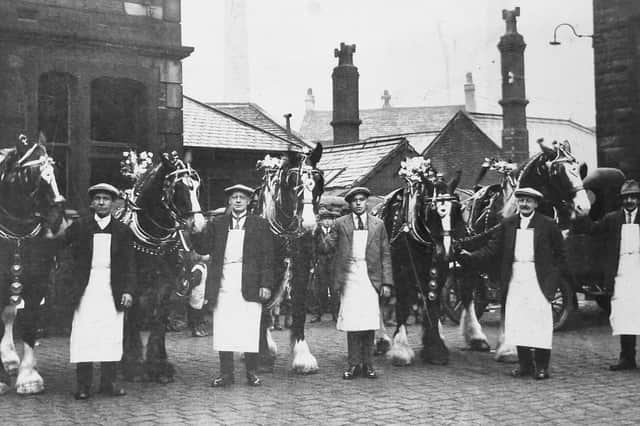

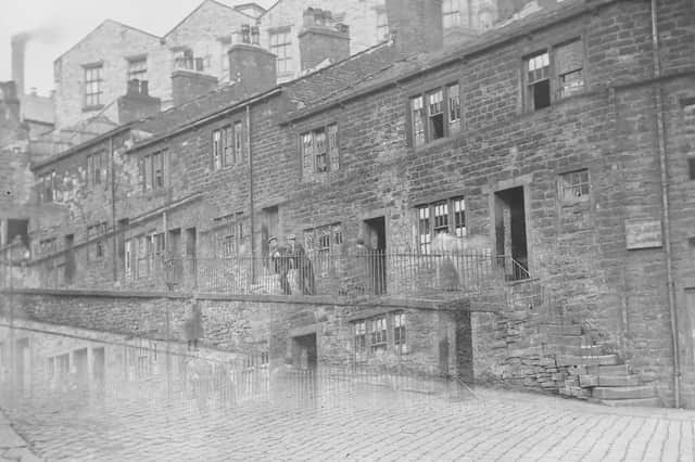
Our video also looks at some now long-neglected steps at the bottom of Sandygate which once led to a former pencilling shop.
Pencilling was a process in the textile industry, which saw patterns placed on cotton or wool through the use of blocks.
We next take a brief look at Lower St James’ Street, featured in an earlier Bygone episode, another ancient route out of Burnley, before finishing our journey at two very significant features of this area of Burnley.
Firstly we examine the Water Meetings - where the Brun and Calder met - and still overshadowed by the ruins of the former Cuckoo Mill, just about Burnley’s oldest surviving cotton mill.
Finally, we disucss a blue heritage plaque erected in the memory of Helen Macfarlane, author of the first English translation of Karl Marx and Friedrich Engels’ seminal socialist publication ‘The Communist Manifesto’.
Roger added: “Helen Macfarlane lived near this spot at the time she translated the famous tome into English. It was quite remarkable. Burnley was the first town in England to have a copy of The Communist Manifesto, giving it a significant role in socialist history.”