Planning application made to Burnley Council to build nine houses on land in Lower Rosegrove Lane
and live on Freeview channel 276
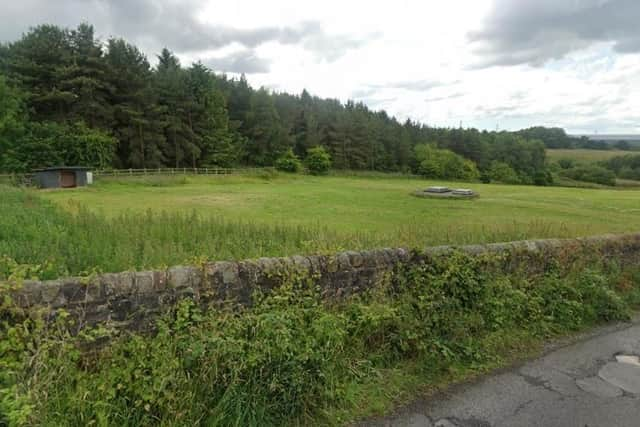
Permission in principle, for the erection of a mix of detached houses and bungalows, has been made for land off Lower Rosegrove Lane.

A report to Burnley Council by LJG Planning Consultancy Ltd on behalf of DVL Properties Ltd describes the one hectare site as an ‘undeveloped parcel of land’ bound by a combination of existing stone walling, post and rail fencing and dense woodland. It also states the surrounding area is mixed, with existing residential development to the north and beyond that, a large scale, strategic employment site on Liverpool Road.

Advertisement
Hide AdAdvertisement
Hide AdTo the west of the site is open land, served by the Padiham Greenway, which offers a traffic free, surfaced and partially lit path for pedestrians. To the north, the towpath of the Leeds Liverpool canal can be accessed a short distance from the site, which again offers opportunities to walk and cycle, away from the main highway network.
The report adds that the site lies within a number of local services, shops, restaurants, schools, leisure and employment opportunities and also public transport. It is also described as a ‘highly accessible’ location for a new residential development due to the proximity of junction nine of the M65.
The report also states that accessibility is further enhanced due to the presence of national cycle routes in the immediate vicinity.
There are also a number of public rights of way nearby with direct access to the Padiham Greenway, which allows users to reach the Burnley Bridge strategic employment site in a matter of minutes, as well as offering opportunities for outdoor exercise and recreation such as running or cycling. The majority of the site lies in Flood Zone One and the report points out that this means it is therefore at low risk of flooding.
Advertisement
Hide AdAdvertisement
Hide AdThere are no known protected trees within or adjacent to the site and Lancashire County Council records show public rights of way in the surrounding area, however, no diversions or closures would be necessary to facilitate the development, according to the report.