Gritters ready to hit Lancashire’s roads as temperatures set to plummet overnight
and live on Freeview channel 276
Where will gritting take place across Lancashire?
Gritters are scheduled to salt all priority routes in Lancaster and the Wyre District on Tuesday (April 11).
The announcement came after forecasters predicted temperatures could plummet to -0.4C in parts of the county overnight.
Which routes are classed as a priority for gritters in Lancashire?
Advertisement
Hide AdAdvertisement
Hide AdPriority roads for salting include, non-trunk Motorways, A-roads, B-roads (in and out of towns), roads which lead to hospitals, emergency service stations, main employment centres, and important public transport routes as well as single routes into villages.
Lancashire County Council is responsible for gritting the following areas: Lancaster, Wyre, Fylde, Burnley, Hyndburn, Ribble Valley, Rossendale, Pendle, Chorley, Preston, South Ribble and West Lancashire.
Residents are also being warned that priority routes only cover a third of the highway network, and ice patches can develop on treated surfaces caused by water run-off from fields or other sources.


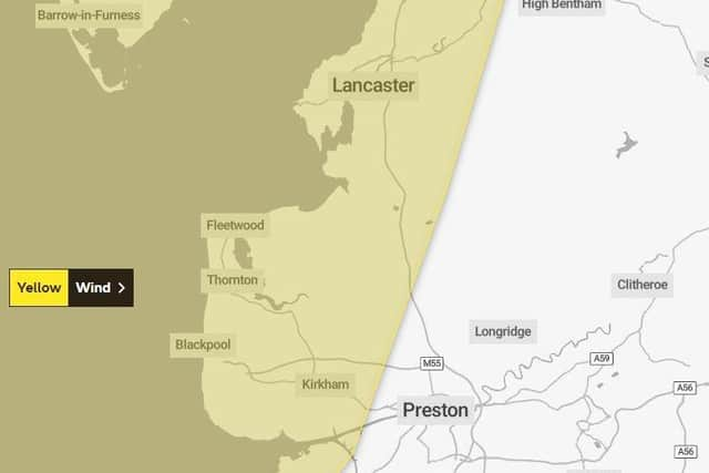
Yellow weather warning as 60mph winds set to batter parts of Lancashire
The yellow weather warning – which covers the Fylde coast and Lancaster – came into force at 3pm on Tuesday (April 11) and will remain in place until 11pm .
Advertisement
Hide AdAdvertisement
Hide AdHeavy rain is also forecast during the evening with a 90 per cent chance of rain predicted between 3pm and 9pm.
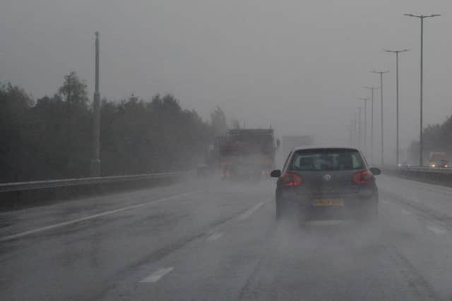
Gusts of 45-50 mph are predicted inland, with 60mph winds possible around some Irish Sea coastal areas.
Met Office Chief Meteorologist, Matthew Lehnert, said: “A low pressure system will bring a period of wet and windy weather today and tomorrow.
“Thick cloud and heavy rain will continue to push in from west bringing 50 to 60mph winds along western coasts.”
Advertisement
Hide AdAdvertisement
Hide AdThe Met Office forecasts weather to remain unsettled as the week goes on before temperatures start to rise heading into next week.
Those living in areas covered by the warning have been warned to expect:
- Some delays to road, rail, air and ferry transport
- Delays for high-sided vehicles on exposed routes and bridges
- Some short term loss of power and other services possible
- Coastal routes, sea fronts and coastal communities will be affected by spray and/or large waves