History of the Bottom o’ th’ Town


We use neither phrase very much these days and they are two of the many old names that have fallen into disuse. How often, recently I mean, have you heard anyone refer to the Irish Park, or Keighley Green, or Lane Bridge or Wapping? All four place names were in frequent use in Burnley not all that long ago but I suppose, these days, not many of you, as with “Top o’ th’ Town” and “Bottom o’ th’ Town”, will not know where any of them were.
I suppose something like this is only to be expected. When a name falls out of use it is quickly forgotten. Similarly, if the area is subject to demolition the name might not be used again. This happened, in very quick time, to Pickup Croft, site of the present bus station in Burnley town centre. I was only looking at a photo, taken of the area in the 1950s, the other day. On one hand it seemed familiar but, the more I looked at it, the image seemed to have come from another, less complicated age.
Advertisement
Hide AdAdvertisement
Hide AdOf course it had. The image was taken almost 60 years ago. The tiny houses, in their long dominant terraces, were still lived in then. I could bring to mind children skipping in the back streets, elderly ladies “memowing” to each other from their front room windows to neighbours, in their own front rooms, but on the other side of the street, and little boys quite content with their marbles.
Perhaps the only thing that reminds us of Pickup Croft is Croft Street itself, though anyone who revisited the street, and who had not seen it for 50 years, would not, I think, recognise it. Gone are the buildings that made it distinctive – the Parkers Arms, the Victory Centre, the little store with its wooden shutter that once housed Collinge’s, the hardware shop.
They have all been replaced with some truly terrible buildings, perhaps the worst of the shopping developments of the 1960s in Burnley. It is no surprise to me that agents have difficulty in letting them. Who would want a building as badly designed and built as these? I don’t know what the council was doing allowing them to be built in the first place.
What I intend to do in this article is tell you something, not much I am afraid, about the Bottom o’ th’ Town, but before I do so let me tell you, if you are wondering, where the other places I have mentioned in this article once were. I am sure I have done it before but it may be that I need to do it again.
Advertisement
Hide AdAdvertisement
Hide AdFirst the Irish Park. The proper name, in this instance, is “The Park” but why it should be so called, I would have to admit I am not sure. Many towns have an area once known as “The Park” or simply “Park”. In Blackburn, for example, there was an area called Grimshaw Park, once one of the better parts of town.
When a place is known as “The Park”, or something like it, it is usually a reference to an old park attached to a large residential property, often demolished. Alternatively, the reference could be to a hunting park or more recent municipal park. In more modern times, the use of the term denotes an area for the better sort of housing as in Victoria Park, Manchester, which I knew quite well when, a lifetime ago (or so it seems), I was a student at the university there.
In Burnley we have our Ightenhill Park Lane which people think refers to Ightenhill Park which opened in 1912 on land donated by the then Lord Shuttleworth. However, that is not the case. The “park”, in this example, is the medieval hunting park which once existed at Ightenhill. The proper name of the parish remains, to this day, Ightenhill Park, but the council does not use its full name as it has been thought that, if it did so, people might think its powers were limited to the present municipal park!
So I remain at something of a loss as to why the town centre location was once known as the Park, or simply “Park”. The area, of which the main streets used to be Bridge Street and Bank Parade, is not near an old municipal park, nor was it once used for hunting. Neither did the land give access to an old hunting park.
Advertisement
Hide AdAdvertisement
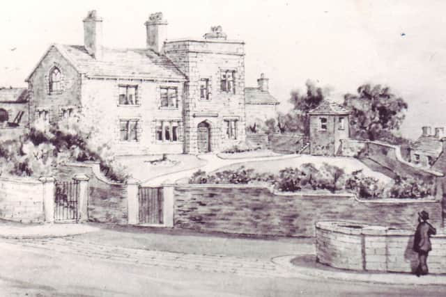
Hide AdMy best guess is that it might have had something to do with the former Bank House estate. There is still a Bankhouse Street and where the former county court now stands is where Bank House itself once stood. The land attached to the estate was distinctive with its small, well-watered fields and hedges of hawthorn and blackthorn. But did it look like a park, was it separate enough to be thought of as a park? I do not know. But you might. If you have a theory, please let me know.
As for the later name – that of the “Irish Park” – that is easy to explain. You only have to look at the 1841 census and compare it with the one published 10 years later. In that decade, because of the tragedy that was taking place in Ireland in the 1840s – the Hungry ‘40s – the Potato Famine, scores of Irish families made their way to Burnley looking for work. It was to the Park they came and the place soon became known as the “Irish Park”.
Keighley Green was to the east of the Irish Park, on the site of the present St Peter’s Centre. The first syllable in the first word comes from an ancient personal name. The second refers to a field and “Green” is a reference to the fact the land was formerly one of Burnley’s two village greens. The other one was at Shorey, another name that has fallen into disuse.
Lane Bridge is an easy one. It refers to Parker Lane, the main street in this area, and to the bridge built to carry the lane over the river Calder. Wapping is a transposed name, meaning it has come from somewhere else, which might also be the case with Keighley Green, now I come to think of it. The Wapping I have in mind is in London. It was an area of housing, tightly packed among industrial and commercial buildings and Burnley’s Wapping was like that.
Advertisement
Hide AdAdvertisement
Hide AdSo we must now get to the Bottom o’ th’ Town. This area has been in the news recently. It happens every so often, when the businesses that operate there call on the council to make improvements. I wish the council could have done something, by now, but, in recent years, funding to Burnley Council has been cut by about a third and regeneration funds are a fraction of what they once were.
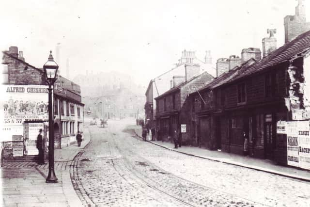
The Bottom o’ th’ Town is the name that refers to what we, inaccurately, refer to as Lower St James Street. It is only lower in the sense that, as it is nearer the river, it is on slightly lower land, but the street contains the higher property numbers. This area also contains the Crows Nest area and Caldervale, both names which, again, are not used very frequently today. They also are near several other names which are similarly out of fashion – the Meadows, Newtown, Orchard Bridge.
The truth about the “Bottom o’ th’ Town” is that the name describes exactly what it once was, the bottom end of the township of Burnley, the part of the township which formed the border with Habergham Eaves. When the area is first noted, in the middle ages, the area was known as “the Brig” as it huddled around the old bridge over the Calder, the real boundary between Burnley and Habergham.
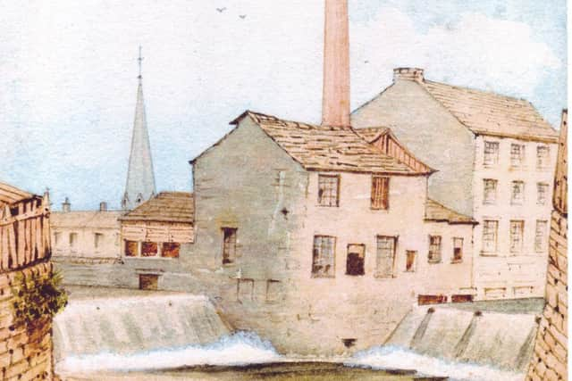
The area was developed for industry, the river providing the power for a fulling mill and other buildings, including a dye house for the wool industry. It was here that a spa house was once established and it was the site, from 1750, of the Bridge End Brewery, later occupied by the Massey family. Cotton came to the area very early (in the 1790s) when a large brick spinning mill was built by the Peels at Crow Nest and a hand printing works was established at Windle, or Wind Hill, better known as Sandygate. The Peels also established a calico printing works around 1800 at Caldervale which, in 1875, became Burnley Paper Works, now the site of Burnley College and the University of Central Lancashire’s Burnley Campus.
Advertisement
Hide AdAdvertisement
Hide AdThe pictures I have chosen today perhaps they do not show just how industrialised the Bottom o’ th’ Town actually was. Industrial buildings dating back to the 17th and 18th Centuries, together with many more in the 19th, usually resulted in mean housing and there was plenty of that in the Bottom o’ th’ Town.
Lastly, I hope the businesses of the “Bottom o’ th’ Town” are able to put the funding together, with the council, to make the necessary improvements. It is, of course, needed and is long overdue.