PEEK INTO PAST: Wapping’s history revealed


The image is taken from a postcard but I have only got a copy. As a consequence there is no stamp or frank mark, which often helps with dating. There are clues as to the age of the image but I will come to them later.
Postcard collectors are often relieved to find the makers of the image have outlined the location of the view they are selling. This was not always the case and, in a monthly magazine for postcard fans, one of the features is a section in which cards lacking location details are published with a request for identification.
Advertisement
Hide AdAdvertisement
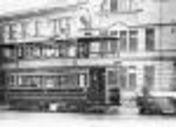
Hide AdFor today’s image we have no guidance about location but, for anyone who knows, even a little, about the history of Burnley, there is one big clue – the clock on the building behind the tram. This is the best view we have seen of what was, once, one of the most well-known features of town. Countless people met under the clock – Burnley’s equivalent of Londoners meeting under the clock at Waterloo.
The clock was attached to Burnley Tram Office at 27 St James’s Street. The tram office itself is the building with the arched features on the right of the photo with a St James’s Street sign on the building. To the right are the offices of Refuge Assurance Co. Ltd at 35; Rennard’s Bros drapers at 33 and The BSK Café, at 31. There was another building, at 29, between the café and tram office, and this was Burnley’s Public Health Office.
Not shown in the picture, to the right of the tram office, were the Palace Theatre & Hippodrome and the Grand Super Cinema but I am not sure they were there when this picture was taken. At first I thought they were as there appeared to be something attached to what would have been the Palace and tram office but, on further examination, I think this structure is part of one of the tram shelters.
Now we get to the reason for publishing this picture. Occasionally, I write about letters or phone calls I receive from readers. I am always happy to receive them but, rarely, people contact me but are unhappy with my response to their request. An example of this involves today’s picture. Some time ago I wrote about the part of the town centre you see here, but before these buildings were constructed. We know what the area looked like partly because a few old photos survive but, largely, because we have detailed maps which speak volumes about the area locals called Wapping.
Advertisement
Hide AdAdvertisement
Hide AdI admit the image of the buildings today is not normally regarded as being part of Wapping but the area immediately behind was. John Lowe, in his architectural study of Burnley in 1985, reproduces a drawing he made to explain what that area was like in the mid-19th Century.
Wapping was a tight and compact part of Burnley bounded by St James’s Street, Water Street, Cannon Street and Hall Street though it could be argued the land to Bridge Street, west of Water Street, and Cross Street (a continuation of Cannon Street) should be included. If we look, in detail, at the district we find there were other streets in Wapping – Townson’s Street and Robert’s Square being two.
The property in St James’s Street had been built as houses for respectable families but were converted into shops though the upper floors of some of the houses remained living quarters. Behind this row there were at least two substantial industrial buildings, warehouses and tiny cottages, not to mention a few undesirable pubs.
All of this was cleared in the last quarter of the 19th Century but it was not all replaced at the same time. The land which later accommodated the Palace and Grand was the last to be developed, in the first decade of the 20th Century. However, the names of the streets remained constant with the exception of this part of St James’s Street, formerly Blucher Street, and Cross Street, which was dropped in favour of calling the run of property Cannon Street.
Advertisement
Hide AdAdvertisement
Hide AdNow to the reason for publishing this picture. The correspondence I received was about Water Street, once a substantial street. Redeveloped, the name Water Street was not dropped, it was applied to the ginnel on the right of the photo. My correspondent would not have it that the ginnel had the name Water Street.
Water Street was not wide enough for a vehicle to pass down but shoppers used it to get to Cannon Street where Burnley’s largest department store, Webster’s, was. I remember the ginnel as it led to the town centre toilets. One had to negotiate steep steps and, somewhere deep in the bowels of the earth, there were large, white tiled toilets. I can’t remember, but I hope the sanitary ware was supplied by the Burnley firm of Duckett’s! I recall was that the toilets were partly lit by glass-covered grates in the pavement of St James’s Street. As people bustled across them, running for a bus, there was a sound like distant thunder as shoes rattled across the glass.
In the picture you may be able to make out some of the features of the Water Street elevation of the tram office. I feel sure white-glazed bricks were used to reflect what natural light there was in the ginnel. The windows were not unlike those at the back of the town hall which also has white glazed brick. I wondered if the builders or the architects of the tram office and town hall were the same?
Lastly, the tram is a Burnley Corporation Tramways vehicle. The “B.C.” on the low vehicle, right, was not continued as BCN but BCT. BCN (Burnley Colne & Nelson) did not emerge until 1933, years after today’s photo was taken.