More heavy rain and strong winds set to hit Lancashire as Met office issues 15-hour weather warning
and live on Freeview channel 276
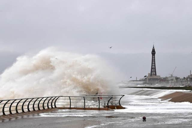
Forecasters predicted winds of up to 60mph could batter parts of the UK on Friday (January 13).
Up to 30mm of rain was also expected to fall in most places – and up to 50mm on hills – bringing the risk of flooding.
Advertisement
Hide AdAdvertisement
Hide AdA new yellow weather warning for rain was subsequently issued by the Met Office.
The warning – which covers all of Lancashire – will be in place from 9pm on Friday until midday on Saturday (January 14).

“Outbreaks of rain, heavy at times, will move in from the southwest on Friday evening then persist overnight into Saturday,” a spokesman for the Met Office said.
“With conditions already very wet this is likely to cause some flooding.

Advertisement
Hide AdAdvertisement
Hide Ad“The rain will also be accompanied by strong winds, with gusts of 40-50mph and possibly 60mph on some exposed coasts in the south.”
Multiple flood alerts remain in place across Lancashire, including the River Wyre, Lower River Ribble, River Lostock and Lower River Douglas.
Residents were urged to monitor local water levels and weather conditions, as well as avoid low lying footpaths or entering areas prone to flooding.
Here’s what to expect, according to the Met Office:
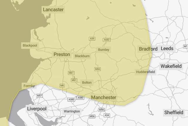
- Flooding of a few homes and businesses is likely
- Bus and train services probably affected with journey times taking longer
Advertisement
Hide AdAdvertisement
Hide Ad- Spray and flooding on roads probably making journey times longer
- Some interruption to power supplies and other services likely