Could the North West be in for a harsh winter?


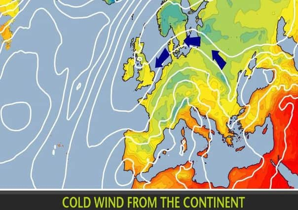
Temperatures have dipped noticeably this week, as high pressure currently dominates the weather over the UK with winds from the east bringing cold air.
Many places will stay dry with bright days and chilly nights with temperatures around, or a little below, average for the time of year.
Advertisement
Hide AdAdvertisement
Hide AdHowever, there will be some showers, especially along eastern coasts and in the southeast of England over the next few days.
But the Met Office adds, “there is no sign of any snow for the UK, but low overnight temperatures will allow some localised frost and fog to form.”
A strong “El Nino” climate phenomenon taking place in the Pacific, which can affect the weather around the world, could spell a colder than usual winter in northern Europe.
A long-range forecast from Exacta Weather shows the potential for months of heavy snow, and expects the first flakes to start falling in Yorkshire in December and continue until March, although the earliest snowfall could arrive by early November.
Advertisement
Hide AdAdvertisement
Hide AdExacta Weather forecaster James Madden said: “It is likely to turn significantly colder from mid October onwards.
“This is likely to bring the first significant snow of winter above higher ground in parts of Scotland and potentially to some well-elevated parts of Northern Ireland.
“Some potentially wintry showers could develop in some other parts of the country during the evening or overnight when temperatures will dip with the strong influence of some cool northerly winds.
“The cold winds will allow it to be more settled, but during some periods of showers or unsettled weather we could see some wintry showers developing in places, particularly in some rural parts of the country.
Advertisement
Hide AdAdvertisement
Hide Ad“Some much lower levels of the country could see some early wintry showers during the latter part of October and into November.”
Early winter migration
The Met Office has also reacted to the early arrival of a migrating Bewick’s swan from Russia.
The swan arrived at the WWT Slimbridge Wetland Centre, Gloucestershire, on Sunday, the earliest date since records began at the site in 1963.
It is thought low temperatures, snowfall and north-easterly winds in Russia have encouraged Bewick’s swans to start their westwards migration through Europe early this year. The swans have also been spotted on lakes in the Netherlands.
Advertisement
Hide AdAdvertisement
Hide AdWWT studies have shown that the weather is a major influence on when Bewick’s swans migrate from Russia, with the wind direction being a particularly crucial factor.
Unusually cold weather has developed over a large part of continental Europe and is likely to persist through this week with temperatures around 5-10 degrees below average. Daytime temperatures in Russia on Monday were around 3-4C which is more like the average nighttime temperature for this time of year.