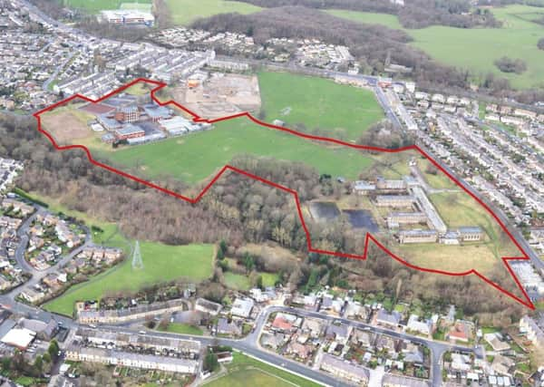
List of sites for 2,700 new homes across Burnley and Padiham


The Burnley Local Plan has identified 34 sites across the borough – a mix of brownfield and greenfield – to build the houses which include detached, semi-detached and sheltered housing.
Some of the most prominent brownfield sites include the former Baxi and Perseverance sites in Padiham, Lambert Howarth in Finsley Gate and land at Burnley General Hospital.
Advertisement
Hide AdAdvertisement
Hide AdGreenfield sites, which attracted criticism from residents when they were first mooted, include Red Lees Road in Cliviger and land in Worsthorne.
When the first draft of the Local Plan was published in September, 2014, the Burnley Express revealed the anger of Worsthorne residents when a number of sites in the village were identified.
However, land at Brownside Road and Butchers Farm in Worsthorne, originally earmarked for 64 and 130 houses respectively, has now been withdrawn due to unsuitability. A site next to 250 Brownside Road has, though, been earmarked to build 18 “high quality” homes, while the former Heckenhurst Reservoir has been highlighted to site around 60 houses.
Another site which attracted controversy when it was first identified was Red Lees Road in Cliviger, which has been found to be acceptable for around 125 houses.
Advertisement
Hide AdAdvertisement
Hide AdThese will include a mix of dwelling types including detached or semi-detached houses.
The following is the full list of sites and number of dwellings identified:
• Former Hameldon Schools sites (Greenfield/Brownfield) (300)
• Hollins Cross Farm (Greenfield) (216)
• Former William Blythe Site (Brownfield) (151)
• Land at Rossendale Road (Greenfield) (188)
• Former Baxi Site (Brownfield) (175)
• Lambert Howarth (Brownfield) (150)
• Ridge Wood (Greenfield) (120)
• New Hall Street/Barden Lane (Brownfield) (13)
• Red Lees Road, Cliviger (Greenfield) (125)
• Higher Saxifield (Greenfield) (120)
• Land at Burnley General Hospital (Brownfield) (64)
• Former AIT Site (Brownfield) (95)
• Peel Mill (Brownfield) (94)
• Waterside Mill (Brownfield) (86)
• Former Heckenhurst Reservoir (Greenfield/Brownfield) (60)
• Tay Street (Brownfield) (49)
• Former Gardner Site (Brownfield) (43)
• Former Ridgewood High School (Greenfield/Brownfield) (42)
• Coronation Avenue, Thompson Street (Greenfield/Brownfield) (41)
• Gordon Street Mill (Greenfield/Brownfield) (39)
• Livingstone Mill (Brownfield) (38)
• Lawrence Avenue (Brownfield) (37)
• Perserverance Mill, Padiham (Brownfield) (35)
• Land NE of Sycamore Avenue (Brownfield) (34)
• Ridge Avenue (Greenfield) (24)
• Land adjacent 2 Queens Park Road (Greenfield) (29)
• Former Dexter Paints (Brownfield) (27)
• Land to rear of Bull and Butcher (Greenfield) (24)
• Land at Oswald Street (Brownfield) (20)
Advertisement
Hide AdAdvertisement
Hide Ad• Brampton House, 500 Colne Road (Greenfield/Brownfield) (18)
• Land adjacent 250 Brownside Road (Greenfield/Brownfield) (18)
• Clevelands Road (South) (Greenfield) (13)
• Whalley Road (Greenfield/Brownfield) (6)
• George Street Mill (Brownfield) (143)
People can comment at www.burnley.gov.uk, email [email protected] or write to Burnley Council, Regeneration and Planning Policy, 19 Parker Lane, Burnley.